


AGaze - Sky Vision
Redefining aerial imagery
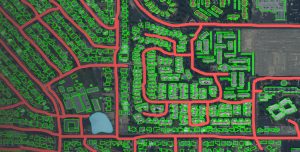
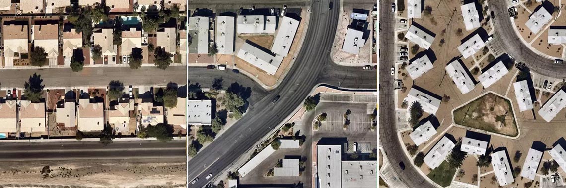
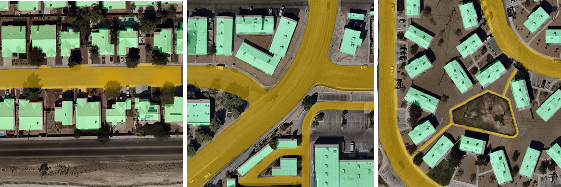
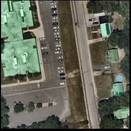
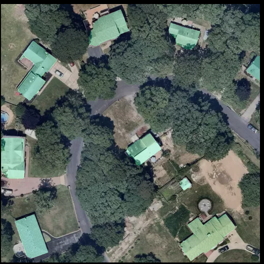
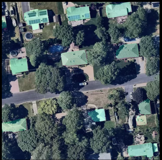
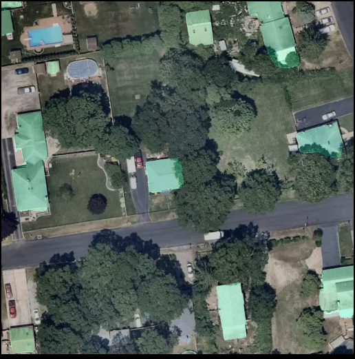
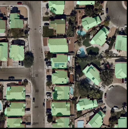
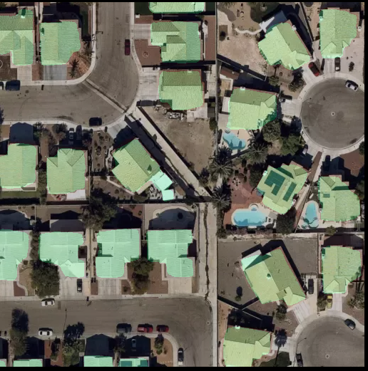
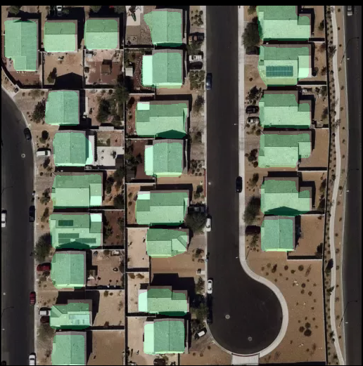
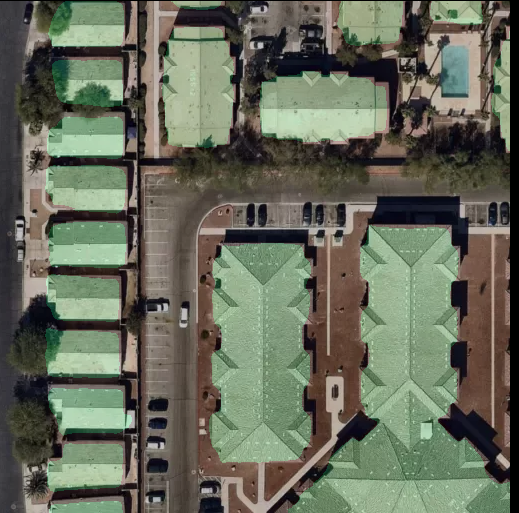
Furthering our effort to transform and simplify the world around us, we have developed an advanced Deep Learning based product that has the capability to detect roads, buildings, trees etc. from satellite imagery. Using Image Segmentation, individual objects from satellite images are detected and classified.
The breakthroughs in Computer Vision applications have made it possible to automate this process, which can turn out to be extremely useful during situations of natural disasters and conflicts apart from issues related to urban planning and policy making.
Computer Vision has proven to be an excellent tool to analyze satellite images of any resolution, detect and classify objects and judge topographical features to provide an all encompassing and detailed feed to the end consumer. Aerial imagery of buildings is quite important for building up information about population distribution and city infrastructure planning including water and electricity lines, public transport, postal services etc. Real time and accurate satellite imagery of buildings and other topographical features gets most useful during risk assessment and relief distribution in the times of natural disasters. The contours of objects such as buildings, trees, water bodies and roads are assessed and labelled.
The network is trained through complex algorithms and a test model is prepared to accurately identify aerial images. Convolutional neural networks (separate for every class of object) are trained and outputs averaged with hyper parameters. Utilizing the expertise of our in-house senior data scientists and architects, we tested our model several times before furnishing the final product.
For demographers and urban planners who rely on the interpretation of satellite imagery, Machine Learning can be used to predict population patterns, urban-rural distribution and poverty levels. This approach will definitely turn over a new leaf in analytics and infuse vibrancy, dynamism and accuracy in scientific predictions - GeoSpatial World.
Unique Features of AGaze
Precise aerial imagery analysis
We, at TensorGo, have invested a great deal of perseverance and research to prepare the most accurate Deep Learning model for detection of buildings and various other objects by assessing geospatial data. Our rigorous methodology involving artificial neural networks for image segmentation has ensured that we produce results that are accurate, foolproof and time saving.
As it is becoming easier to get high resolution satellite images on almost a daily basis, it makes the best sense to incorporate Artificial Intelligence in the process of analysing this high volume data and produce accurate information for better decision making. As all other sectors are shaping and realigning their business formats for the future, remote sensing is also going to see a major shift towards automation and intelligent processing. Some of the areas of business application where this technology can be further harnessed include agriculture, real estate and insurance. The precise aerial imagery analysis can be incredibly useful in a multitude of use cases that are newly emerging every passing day.
As it is becoming easier to get high resolution satellite images on almost a daily basis, it makes the best sense to incorporate Artificial Intelligence in the process of analysing this high volume data and produce accurate information for better decision making. As all other sectors are shaping and realigning their business formats for the future, remote sensing is also going to see a major shift towards automation and intelligent processing. Some of the areas of business application where this technology can be further harnessed include agriculture, real estate and insurance. The precise aerial imagery analysis can be incredibly useful in a multitude of use cases that are newly emerging every passing day.
Interested to know more?
Do you have a potential use case? Fill the below form to contact us.